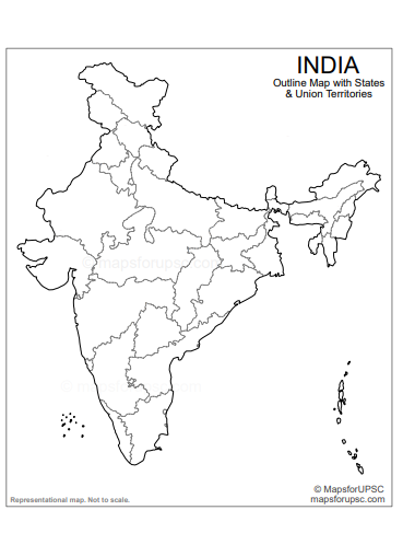
If you are looking for an India Political Map Blank PDF for study, teaching, or exam practice, you’re in the right place. This post provides complete information about Outline Maps of India, including maps with states, without states, and A4 size printable formats that are extremely useful for students, schools, and teachers.
Blank outline maps are an essential learning tool for geography, competitive exams, and classroom activities.
What is an India Political Map Blank PDF?
An India Political Map Blank PDF is an outline map of India that does not contain labels such as state names, capitals, or boundaries (in some versions). These maps allow students to practice labeling, coloring, and answer-writing during exams.
These maps are commonly used in:
- School geography classes
- Competitive exam preparation
- Map-based questions
- Answer key practice
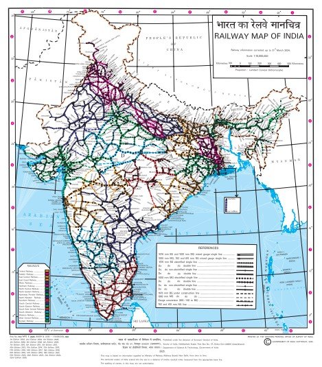
read More: Indian Railway Route Map
Outline Maps of India – Available Types
1. Outline Map of India with States
This version shows state boundaries clearly but does not include state names.
Best for learning state shapes
Useful for labeling practice
Ideal for board exam preparation
2. Outline Map of India without States
This is a completely blank India outline map without internal boundaries.
Perfect for drawing rivers, mountains, or routes
Useful for UPSC / SSC map questions
Helps in conceptual learning
3. A4 Size Printable India Outline Map
All maps are optimized for A4 size printing, making them:
Printer-friendly
Clear and high-resolution
Suitable for worksheets and exam sheets
Why Use a Blank Political Map of India?
Using blank outline maps improves active learning instead of passive memorization.
Key Benefits
- Enhances map-reading skills
- Improves memory retention
- Encourages self-practice
- Helps in quick revision before exams
How to Use India Political Map Blank PDF
Here are some practical ways to use these maps effectively:
For Students
- Practice labeling states and UTs
- Mark capitals, rivers, and borders
- Use for geography answer writing
- Revise map-based questions
For Teachers
- Create worksheets and assignments
- Use in classroom activities
- Prepare exam papers and answer keys
- Conduct map tests
Printable India Political Map Blank PDF – Features
- High-quality PDF format
- Clear India outline
- A4 size printable
- Easy to download and use
- Suitable for black & white printing